
Digital Maps
We supply a range of digital mapping covering Great Britain at a range of map scales based on up-to-date Ordnance Survey data.
Some mapping data attracts print royalties on its usage, whereas some data is specifically royalty free. For data that does attract print royalties we will need to know how you are using it (e.g. for print purpose, internal business use, etc) and how many copies you are printing.
You can see which datasets are available, which have print royalties applicable on their use and which are royalty free in the list of available datasets.
Postcode Maps
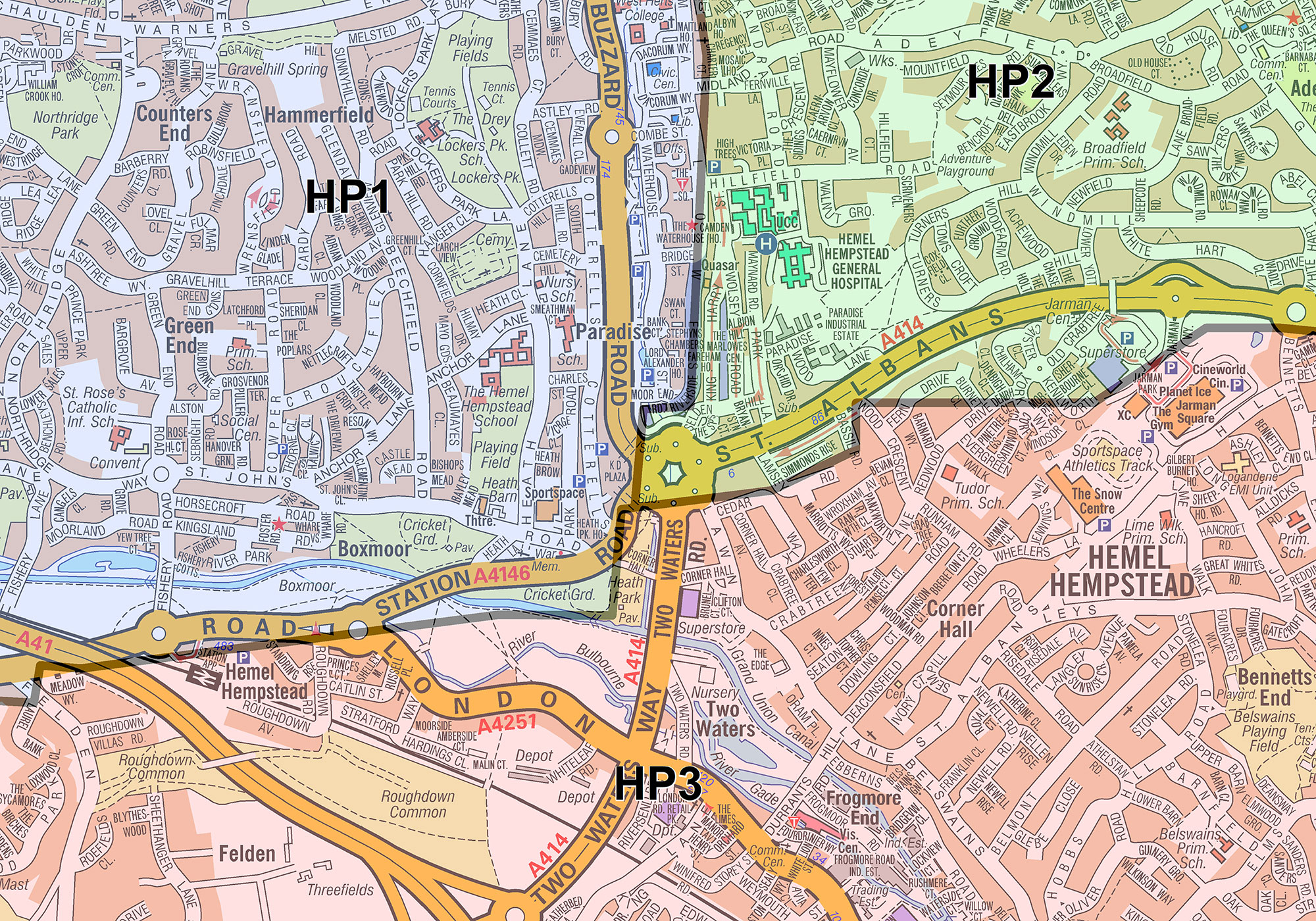
We hold mapping of Great Britain at a range of map scales based on up-to-date Ordnance Survey data including Area (OX), District (OX1) or Sector (OX1 1) level postcodes.
We can supply this postcode mapping in either a digital or a printed format to help your business market, plan or visualise areas.
Postcode mapping for every business need
Boundary Datasets
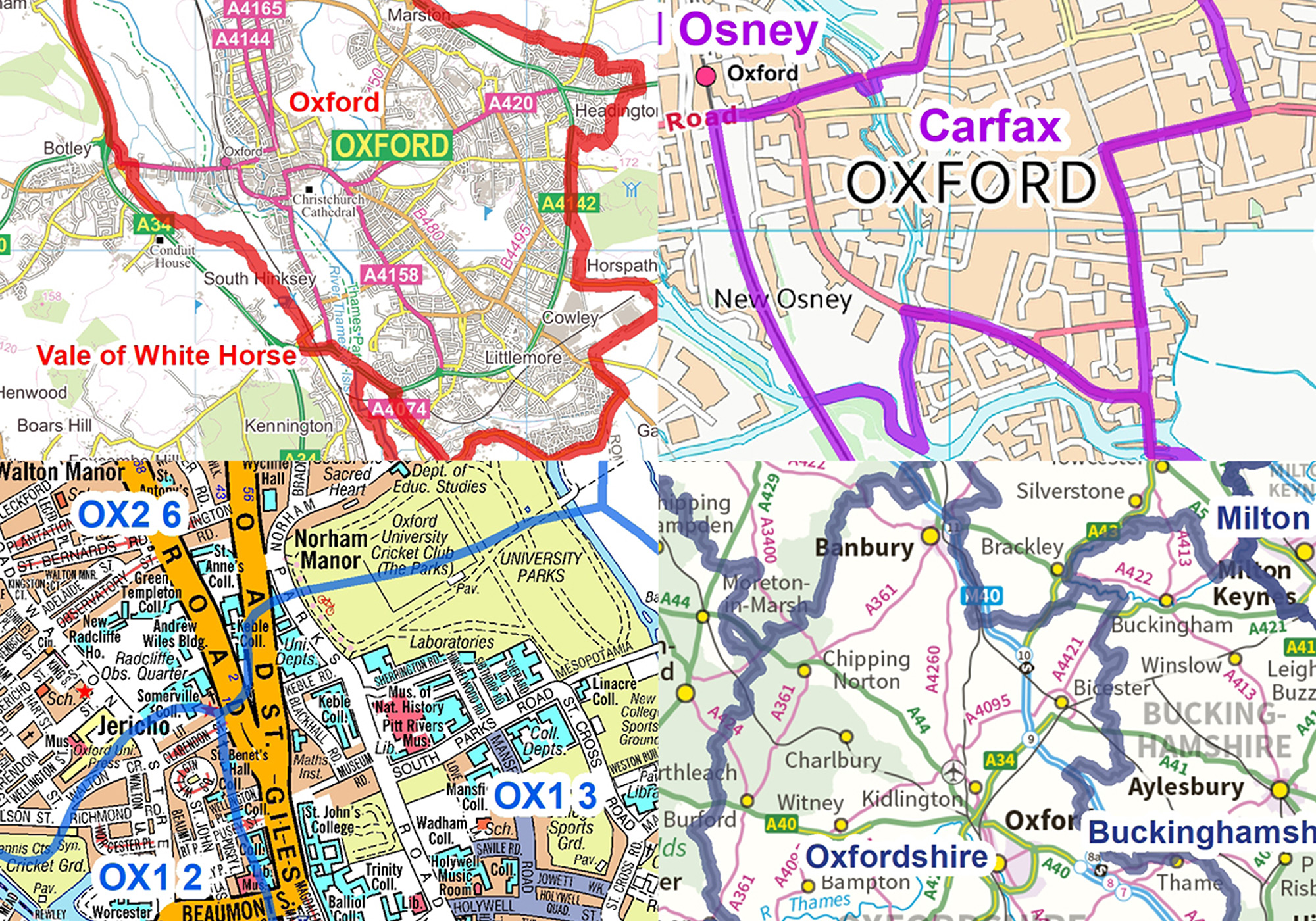
Geographical boundaries can be crucial in determining territories for sales, marketing and a variety of other uses.
We have a range of boundary data available in a range of formats dependent on your requirement.
Marking your territories
Datasets
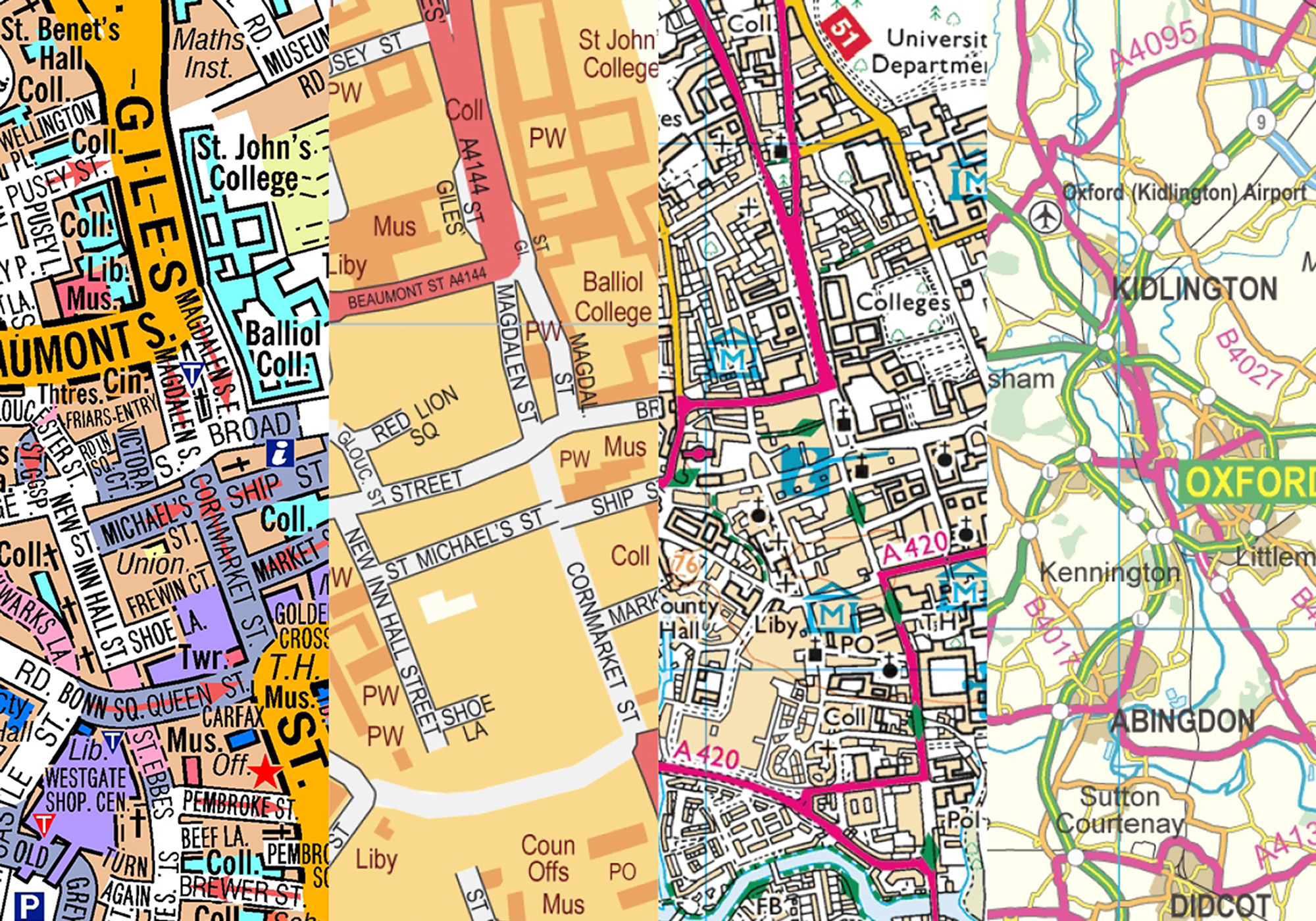
We have a range of datasets for you to choose from, depending on your specific business requirements.
Depending on which one you choose, they are available in vector or raster format, and may either be free to use or might require print royalties.
A choice of data
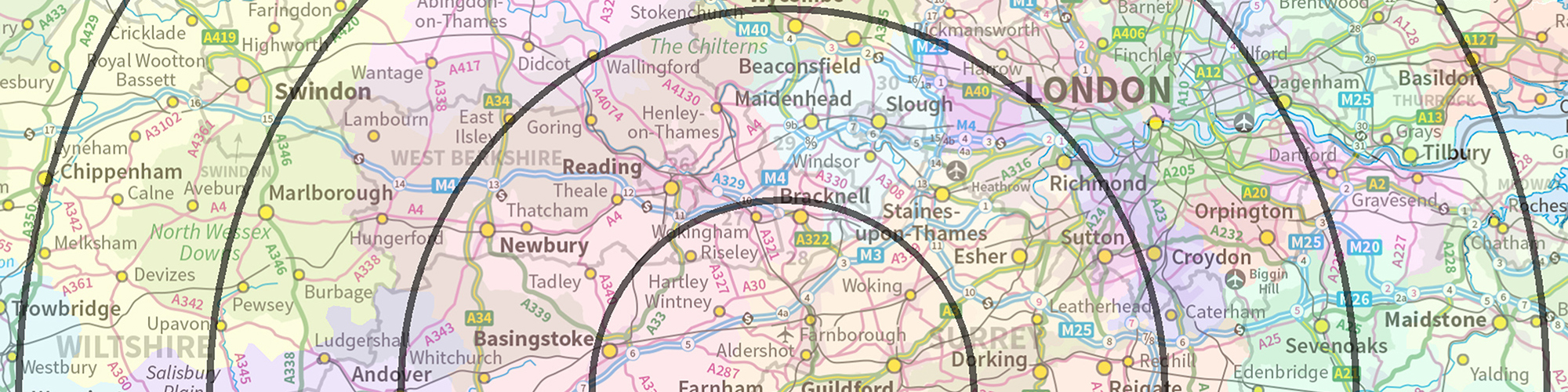
Drivetime Maps
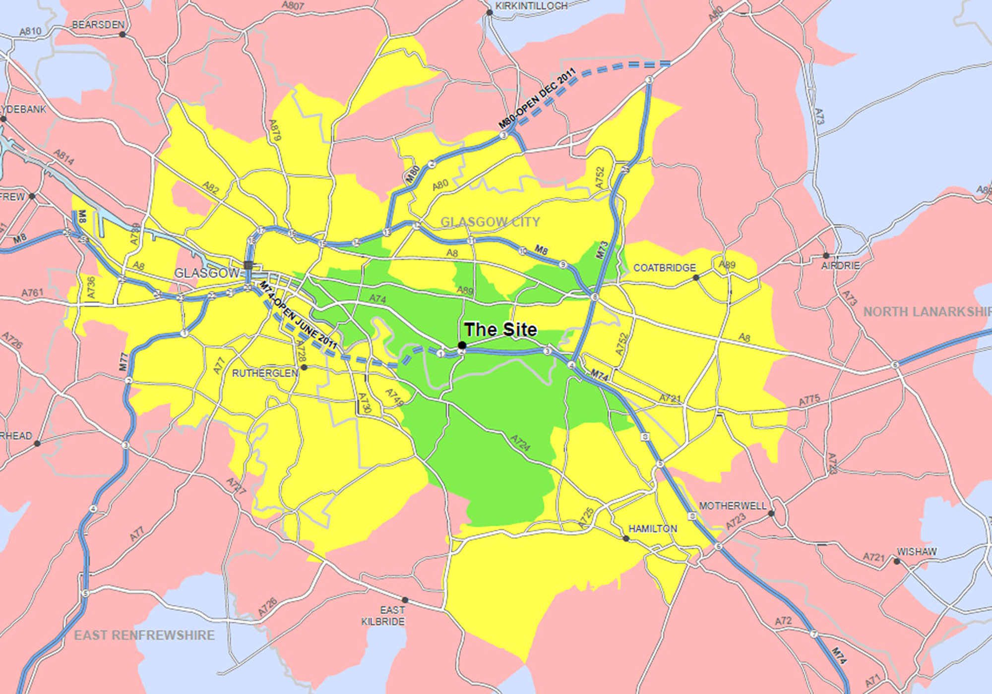
Geographical boundaries can be crucial in determining territories for sales, marketing and a variety of other uses.
We have a range of boundary data available in a range of formats dependent on your requirement.
Clear drivetime maps using a variety of formats
Historical Maps
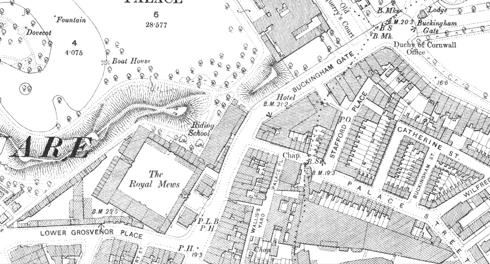
Whenever we supply maps for operational use it is imperative that they contain up to date data.
However, sometimes Historical data is required, either for researching a local or family history, or just have a decorative map to hang on the wall.
We can supply Historical mapping from the Ordnance Survey dating from the 19th Century through to the present day.
Mapping the past
What to consider
We are here to help and can cater for almost any need, but before you call we would advise that you browse the site and consider
- What you want your map to do
- Is it for screen or print?
- What size and finish should it be?
- Do you have any special requirements?